The Urbor Intelligence Platform
Monitor with Precision
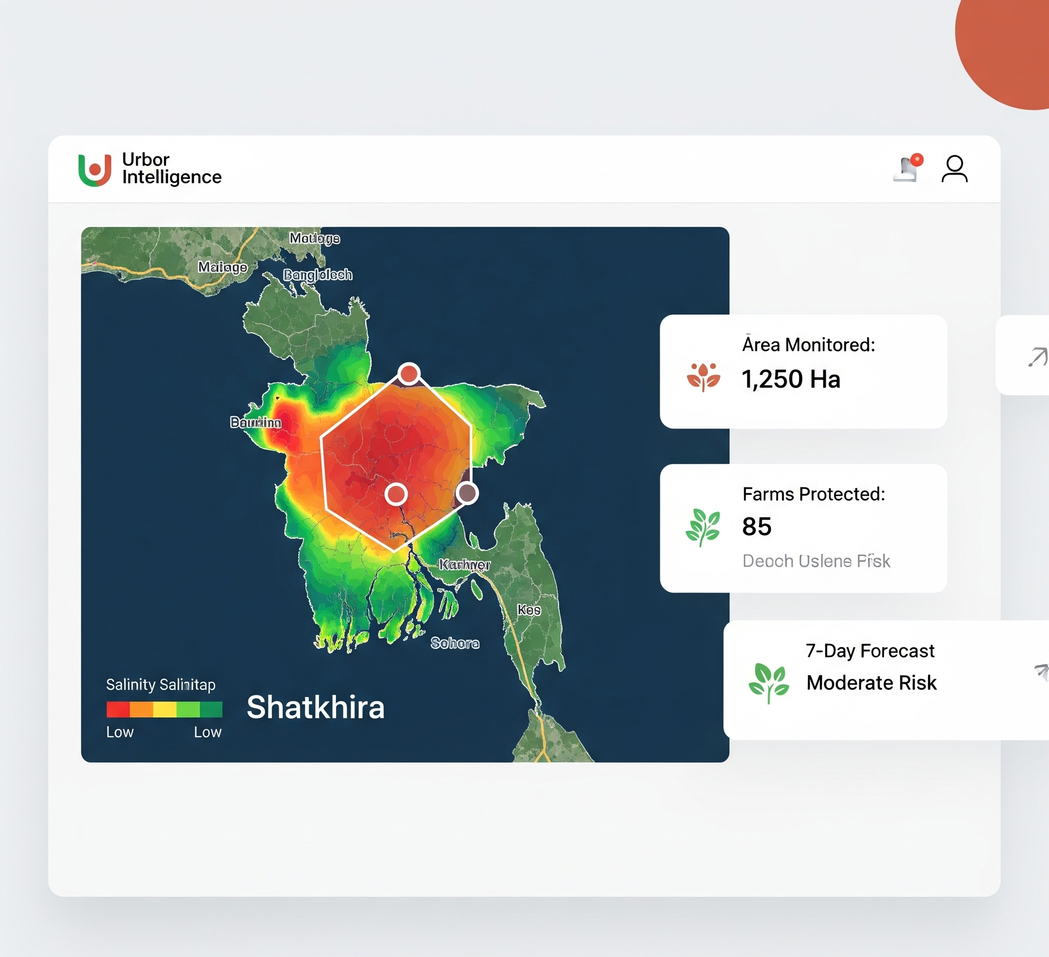
We use geo-referencing and satellite imagery to create detailed salinity heatmaps of coastal regions. This allows us to monitor changing soil conditions with incredible accuracy, identifying vulnerable areas before they become critical problems.

Forecast Future Risk
Our key innovation lies in prediction. By analyzing historical data and environmental trends, our platform forecasts geographical salt intrusion patterns on a day-by-day timescale. This predictive capability allows for proactive land management, optimizing remediation efforts and protecting crops.
Accessible Insights, Anywhere
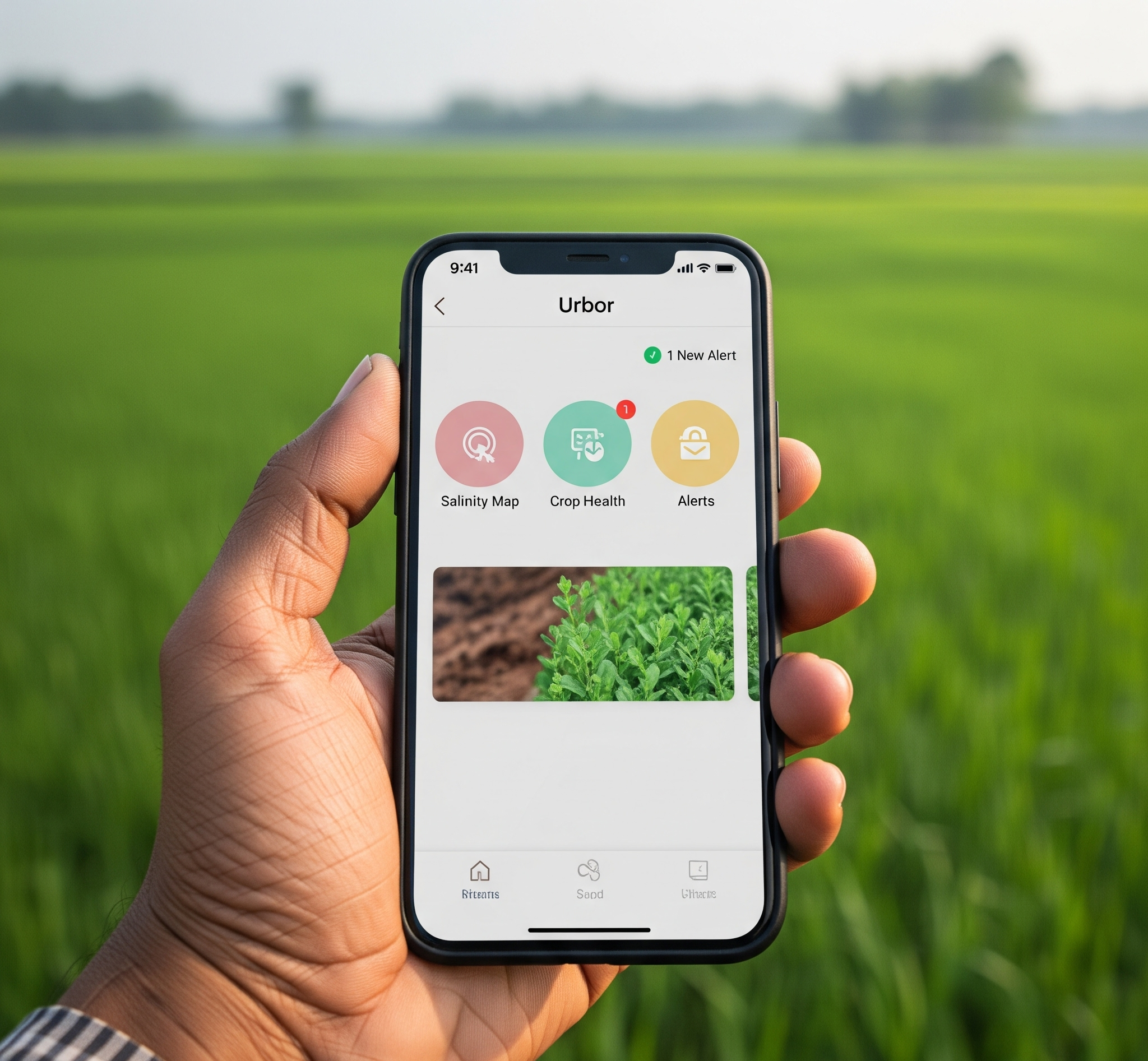
Advanced technology is only useful if it's accessible. We deliver these critical insights through a simple and intuitive mobile application. Farmers can receive alerts, view salinity maps, and access crop health information directly from their phones, right in the field.
Let's Build a Resilient Future
Our work is always growing. Contact us to learn more about partnerships, investment opportunities, or how you can get involved.
Partner With Us